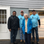
KINGSTON – Local officials joined stewards of the Hudson River Valley Greenway at Kingston Point Beach Wednesday, to announce the launching of newly developed resources that facilitate access to the 256-mile Hudson River Greenway Water Trail.
Included among the goodies are waterproof maps, a revised comprehensive guidebook, and a mobile-friendly GPS navigation website.
The event featured numerous speakers, followed by a kayak fleet paddling around the point, down to Kingston’s Maritime Museum. Mayor Steven Noble, an avid kayaker, joined the flotilla.
Participants gathered at Kingston Point before paddling to the Rondout Waterfront
Established in 1993, the water trail currently offers 100 waterfront access sites to the Hudson River, between Lake Champlain and New York City. There is at least one access launch every 10 miles, on both shores. Additionally, overnight camping is available every 15 miles.
`Hudson River Valley Greenway also manages the Hudson Valley National Heritage Area.
The US Department of Interior designated the trail as a National Water Trail in 2012.
“A water trail isn’t just a nice place to paddle, it is a way to go,” noted Karl Beard of the National Parks Service. “Not just directions, but how to go safely, how to go wisely, how to learn about your own ability, and what’s going on underneath your boat. Plus, some of the back stories.”
“I have to say this may be one of the best access points on the Hudson River for folks, free of charge every day of the year,” said Mayor Noble. “It’s not easy for communities to manage these access points; it takes a lot of work and energy. It takes commitment, and when there’s commitment, things get done.”
For more info see http://hudsonrivergreenwaywatertrail.org