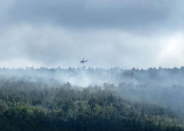
MID-HUDSON – Suppression efforts to contain wildfires continue. In the Town of Wawarsing, helicopters flew over forest fires attacking them from the air with water drops.
A Napanoch fire is believed to have been started by a lightning strike, according to State EnCon officials.
Just before 5 p.m. on Saturday, firefighters were called in to assist to locate a fire in the Napanoch Point area of Minnewaska State Park.
Due to the remote and rugged terrain, State Police Aviation was called in to assist with scouting the fire and provide bucket drops. Two helicopters conducted dozens of bucket drops.
On Sunday, nearly 100 state and local firefighters, working in a joint unified command led by DEC forest rangers, continued the suppression effort.
. The fire was expected to spread overnight and crews will continue to work daily on suppression efforts.
Assisting on-scene are firefighters from Accord, Kerhonkson, Ellenville, Cragsmoor, Napanoch, DEC, State Parks Department, and Mohonk Preserve. Other agencies assisting the effort are the Ulster County Sheriff’s Office, Ulster County Department of Emergency Services, Ellenville Rescue, and homeland security.
Extremely dry conditions and difficult terrain are increasing the challenges of containing the fire.
In addition to the wildland fire in Ulster County, forest rangers are tracking eight fires statewide. On Saturday at 1:25 p.m., Sullivan County 911 requested forest ranger assistance with a fire on private lands in the Town of Mamakating. The fire was originally estimated at approximately 25 acres.
Several helicopter bucket drops attacked the fire from above.
By 9 a.m. on Sunday the fire had grown to 50 acres.
By 2:35 p.m., five rangers and 57 volunteers contained the fire, which started with debris burning.
The Hudson Valley and Catskill regions remain at high fire danger risk (click here for the current Fire Danger Map: https://www.dec.ny.gov/lands/68329.html), meaning outdoor fires have the potential to spread quickly, especially if the wind picks up.